 |
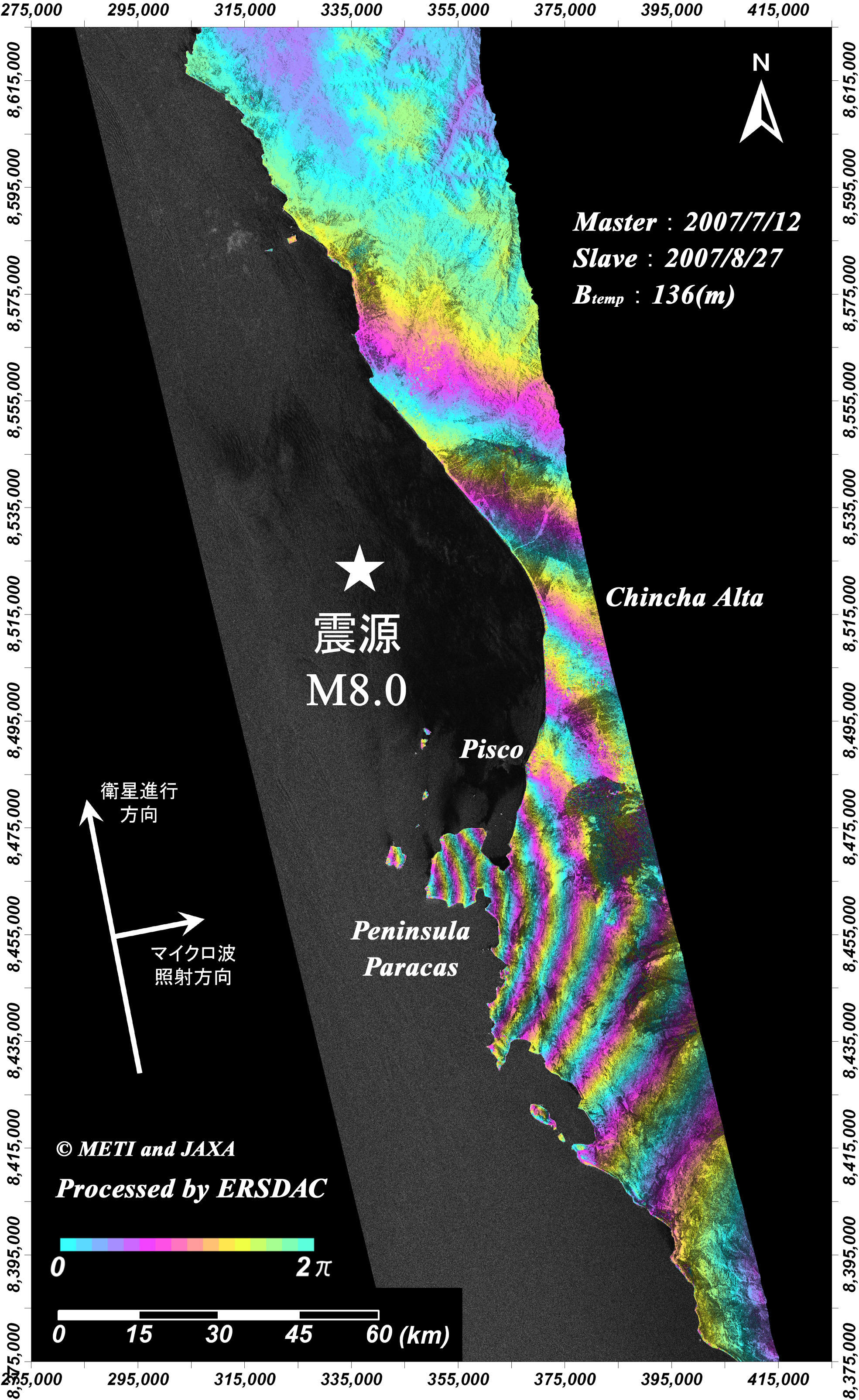
Land Surface Displacement at the Coast of Peru
(InSAR processed image using PALSAR data)
This image captured by PALSAR on board Advanced Land Observing Satellite (ALOS) shows land surface displacement caused by a powerful M8.0 earthquake hit the coast of Peru on August 16, 2007.
ERSDAC analyzed the displacement using the data observed on July 12, 2007 (before the earthquake) and August 27, 2007 (after the earthquake).
The color pattern from blue toward red (blue -> yellow -> red) at Peninsula Paracas in the image indicates that the land surface moved closer toward the position of the satellite.
One cycle of the color pattern corresponds 11.8 cm displacement. Therefore, the image shows that around the peninsula is elevated more than 1.3 meters.