 |
 |
 |
|
2005/10/11 mosaic Tiff Image
Here |
||
|
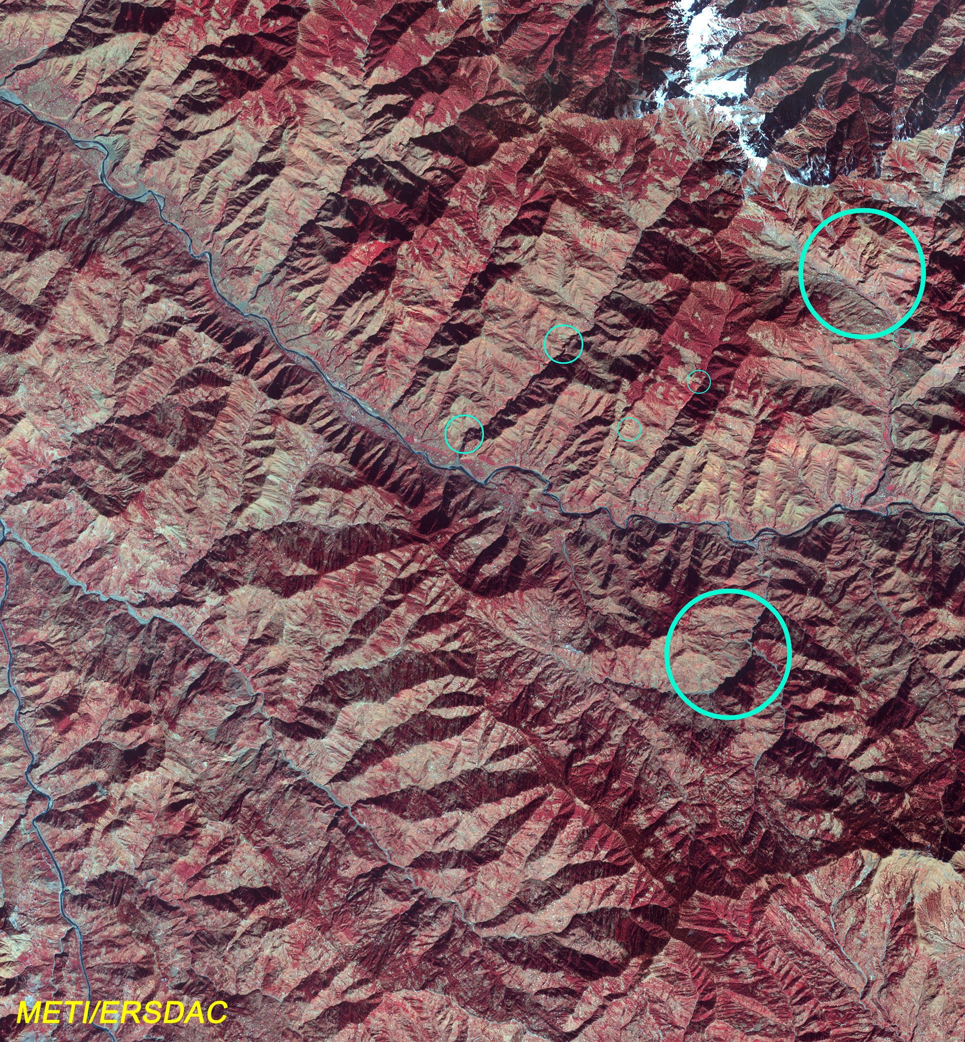
2000.11.14
(B:G:R=Band1:Band2:Band3) |
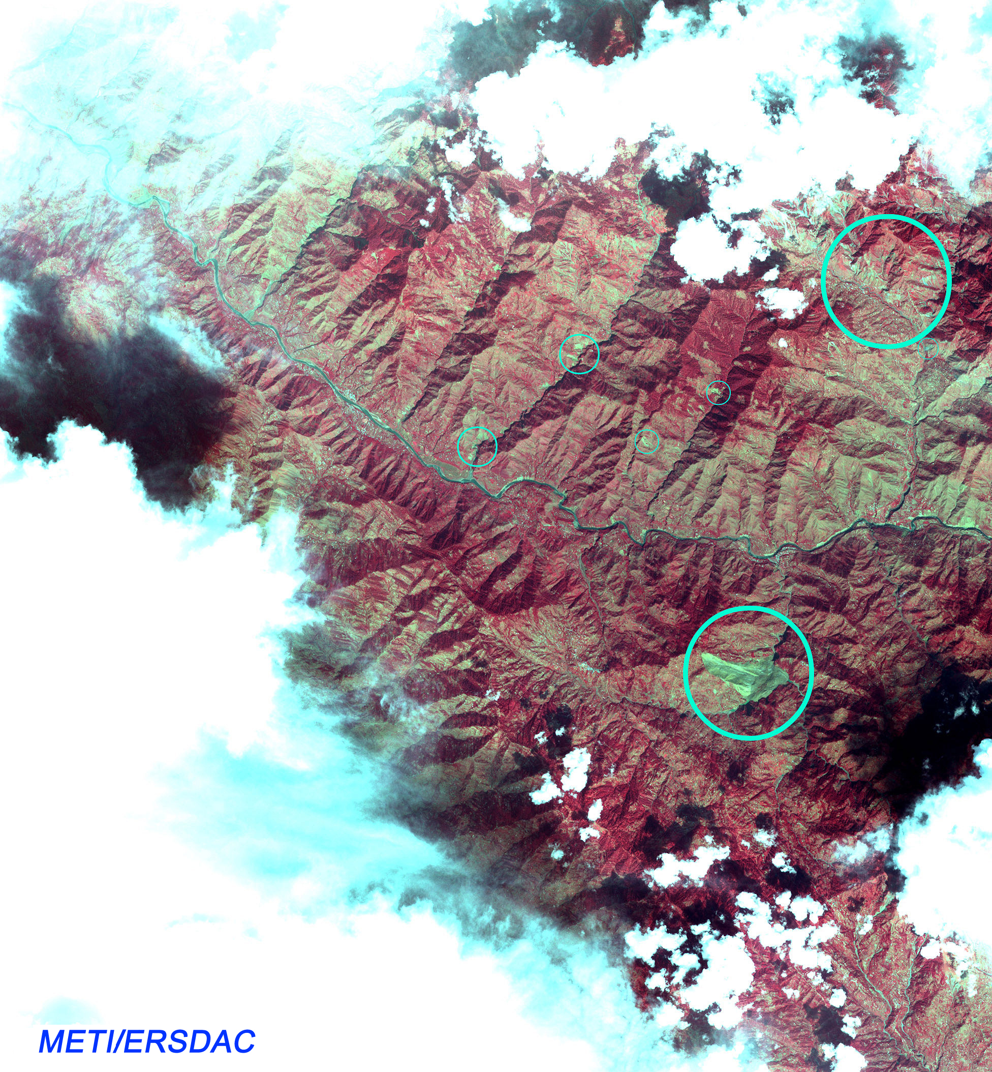
2005.10.11
(B:G:R=Band1:Band2:Band3) |
2005/10/14 up
|
Pakistan Earthquake
The northern part of Pakistan was hit by magnitude-7.6 earthquake in the morning of October 8, 2005.
Sadly, the earthquake has already claimed more than 20,000 lives, and is expected the number to increase as the situation becomes clear.
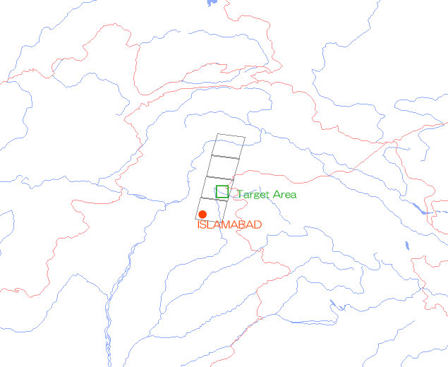
On October 11, 2005, immediate aftermath of the earthquake, we made an emergency ASTER observation of the areas considered to be damage. The mountainous area about 50km northwest of Islamabad (see the site map.) came out breaking through the clouds. This image is shown the right. The image of same area observed on November 14, 2000 is also placed on the left for comparison. A lot of landslide can be identified as we compare the images of before and after the earthquake. The light blue circles in the image indicate the areas estimated to be damaged. Especially, extremely large size landslide is shown in lower right of the center of the image, an area of approximately 800m-wide and 2km-long. Other many medium and small size damages can be identified.
Following conditions shall be agreed and observed for those who wish to use the image.
1) Specify the following information along with the image when releasing it to the public.
* Name of the sensor (ASTER)
* Data from METI(Japanese Ministry of Economy, Trade and Industry)/JSS
2) Duplication and secondary sales of the image are prohibited even if conditions 1) is satisfied.