|
PALSAR Orthorectified Mosaic Image of
Northern Borneo Island (Kalimantan)
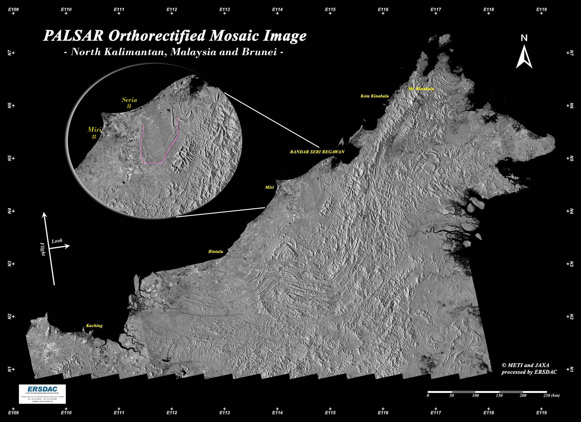
Above is a PALSAR image of northern Borneo Island (Kalimantan), which is located right on the equator, around the western end of the Pacific Ocean.
PALSAR data of 122 scenes over 20 paths have been orthorectified to be used in this mosaic image.
Sabah and Sarawak states of Malaysia, and Brunei nestled in between, are located on the north coast of Borneo Island (roughly in the center of the image).
As is shown in the enlarged image around Brunei, synclinal structure (indicated in pink) can be clearly observed, which roughly corresponds to the country's border. Obviously, its territory has been protected by this natural fortress formed by synclinal structure.
The fine stripe pattern observed around the center of the larger image, which stretches from north-northeast to south-southwest and curves in an east-west direction at its south end, is an accretionary complex formed by expansion of the South China Sea from Cretaceous to mid-Tertiary time. This consists of deep-water sandstone/mudstone and generally gets younger as we go towards the sea.
We can also recognize anticlinal structure in inland areas. The only existing onshore oilfields nearby are the Seria Oilfield in Brunei and the Miri Oilfield in Sarawak along the coast.
However, many oil and gas fields are being discovered and developed on the continental shelf stretching towards the South China Sea, and therefore more active exploration is expected.
There is one of the world's largest LNG plants in Bintulu, an area lying to the south-west of the Miri Oilfield. This plant is gathering natural gas extracted from the continental shelf and exporting it to Japan and other countries.
Mt. Kinabalu (4,094m), a vast granite massif, is located in Sabah at the northern tip of Borneo Island and famous for its rich variety of plants and animals.
|