2005/04/01 up
- Ice Floes in the Sea of Okhotsk-
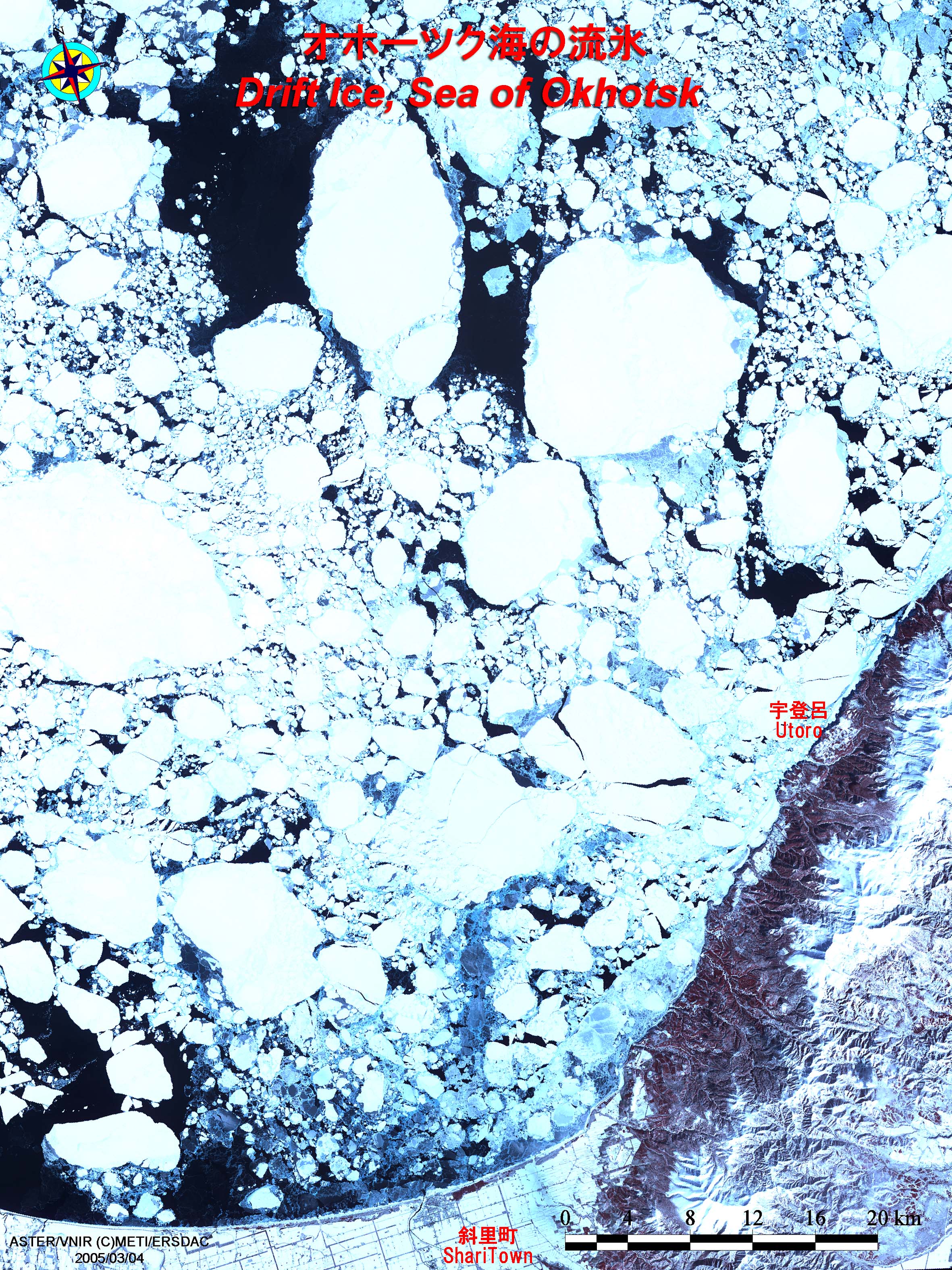
ASTER VNIR L1B
The ASTER Visible and Near Infrared image data taken on March 4th, 2005. It captures the image of the Sea of Okhotsk west of Shiretoko Peninsula off the coast of Abashiri, Hokkaido.
The land area at the bottom of the image is part of Shari town and the Shiretoko Peninsula. Ice floes of various sizes float over the Sea of Okhotsk. The biggest ice floe is over 14km on a side, which is seen in the image.
In the Sea of Okhotsk, the fresh water from River Amur flows into Mamiya Strait, lowering the salt level, therefore, the seawater freeze in the winter. Some of those ices turn into ice floes and are carried to the coast of Hokkaido by seasonal winds and ocean currents.
Wakkanai, Hokkaido, on the coast of the Sea of Okhotsk down to the Shiretoko Peninsula, ice floes begin to appear from mid-January, and washed ashore in February to March, turning the surface of the sea all white.