Almost two years have passed since I came to Hokkaido, the northern island of Japan. I have traveled all over the island and spent more days for field research than I had ever spent at any other point of time in my carrier. I have decided to write about the impressive research in the nature of Hokkaido as a conclusion of the series of essays.
|
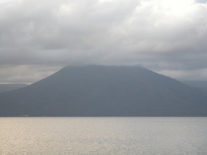
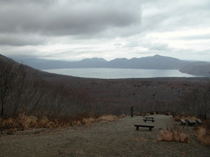
Study on geology starts from field survey and geologists devote a great deal of time for field activities. However, as they get older, they come to spend less time in field due to increased workload, waning physical strength and other reasons. It was exactly the case with me at the previous workplace. Except for survey overseas, I used to spend only a few days for field survey in a year. Geology is a study based on field survey, such as research on stratums or rocks in nature, and detailed examination is carried out indoor based on collected samples from the field survey. Come to think of it, I haven't practiced such survey for more than 10 years and I strongly felt that I do not deserve to give lectures to people about nature and earth if I would continue like that. Ever since I came to Hokkaido, I have tried to contact with nature as much as possible. Restart of the long-neglected field survey activity was one of the attempts. In my university, departments related to literature share larger part and I am the only professor specializing in geology. In such circumstances, I need to be creative, rather than just dedicating in a series of studies based on geological survey, largely exercised in the department of science in other universities. I started to look for a theme of my study centering field survey, in a way that does not require special tools. However, before anything else, I had to readapt myself to nature. I spent my first year in Hokkaido for rehabilitation, by putting myself in nature as much as possible. Finding a theme was postponed until then. Since this spring, I started my field survey in earnest. I have spent 55 days for field survey since the last December until November this year. I do not know the average days a geologist spends for field survey in a year and I am not sure if it is sufficient or not. Some must be sparing more time in fields, while others must be sparing most of their time for indoor investigations, like I had been before. It may reflect the differences of the subject that they study and I just decided to carry out a study putting emphasis on field survey. Theme of my study is unique (refer to "as the conclusion of the series") and I also adopt unique approaches to it. Most researchers carry out field survey by themselves or in a group with other co-researchers or students. There is hardly a chance to bring their families with them for field survey. However, I tried to take my families as much as possible as long as their company does not disturb the survey. The reason for this is partly because my survey does not require special method, which makes it difficult for them to participate, but above anything, I wanted to confirm the reaction of my children, whether or not they can find my study interesting. I spent 29 days in total for the field survey with my family. It may sound like I am an excessively family-oriented person but the purpose of it is not just to entertain my family. It was part of my study to observe the reaction and behavior of my family members. Especially, I wanted to observe how my children interact with nature, what kind of objects that they find curious and how they react to my explanation. My children took benefit of the opportunities. In this year alone, they have traveled with me to such places as Shimanto River in Shikoku Island, Ishikari River, Rumoi River, Shiribetsu River, Shiribeshitobetu River, Saru River, Mu River and Tokachi River in Hokkaido to accompany my investigation walking from the origin to the mouth of rivers. Sometimes it was difficult for my 3-year old son to climb up steep mountainside but the other 5-year old son could follow me even more easily than my wife. While I was engaged in my investigation from 30 minutes to one hour after arriving at the point of research, my children played at a riverbed freely. As long as stones, sands, mud and water exists, they did not lack sources for fun. This is exactly the theme of my study. Knowledge is needless to stimulate interest and curiosity of children if they are taken to the middle of nature. Nature, by itself is the source for curiosity. One of the other themes of my study is how to lead the curiosity to the pursuit of truth, or scientific way of thinking. On the other way around, my family taught me many things during the field survey. At the riverbed of Tokachi River, we tried to find obsidian stone. I was surprised when my wife found one, who has never seen the stone before. She managed to find one merely based on my oral explanation. Since I had a preconception that obsidian stone rarely exists around here, I was almost half-hearted in finding it, even though I suggested it myself. I tried hard to find one following my wife, but I couldn't. I completely lost my face. The other day, I took my family to Shikotsu Lake in Hokkaido. Since it was in the middle of November, No Thoroughfare signs were placed on roads here and there for winter freezing. Luckily, a road leading to Tarumae Mountain was yet to be closed. All of my family members managed to climb up to an observation platform just above the seventh uphill station. There was a long, big gap stair-like path on the way. The observation platform was at a point beyond forest limit and you can have a good command of view from the station. Beautiful shape of Tarumae Mountain, Fuppushidake and as far as Shikotsu Lake and outer rim of a crater could be seen. Since Tarumae Mountain is an active volcano whose exhalation continues, access of people to the crater is forbidden. My elder son seems to have understood that all the mountains he could see from there were made by volcanic eruptions and that whitish lightweight stones (pumice stone) at his feet as well as huge stones (volcanic bomb) of more than 50cm diameter, lay here and there burst out of the crater above him. He seems to have understood those facts by experience, not as a piece of information. Also, he was surprised to know that the large Sikotsu Lake (caldera) beneath him was formed by eruption. He seemed to have imagined the dynamics of volcanic activity, which is a sheer difference from the present quiet figure of the mountain that he could see. Children cannot make estimation based on a map. The size of caldera or the magnitude of outer rim of a crater can only be appreciated by watching it. However, once they see it, they can sense the object beyond words. Children can understand the fact that mountains surrounding them are all made in times of volcanic eruption and can even imagine the magnitude and abnormality of the eruption based on the size of the lake right in the middle of the mountains. I believe fostering the sense like this in the minds of people will lead to better understanding of nature. Unlike study at the desk, nature is a source of impression. Watching and feeling nature give rise to curiosity. That curiosity mixed with deep reflection on it, leads to the understanding of a geological event, that cannot actually be confirmed by seeing but definitely happened in the past. I guess this can be said commonly to everyone, without much difference per individual. I am devoted in developing a method to appeal to people's mind, which ultimately leads to good understanding of nature, in other words, to facilitate learning of science. I know it will take long for the development but that is the direction of my study. This is the last of a series of essays carried on the ERSDAC website. I didn't intend to conclude the essay with the story of my family, but it turned out in this way as a result of picking out Tarumae Mountain as a theme. But anyway, story of my family paralleled the theme of my study I have focused in the past one year. Tasks to be achieved as a scientist vary widely. For example, pursuit of the cutting edge scientific topics and to further advance the area, focus on one region or one theme, and to be engaged in activities to stimulate the interest of people in science. I strongly believe that propagating interest in science is one of the responsibilities of scientists. There needs to be more opportunities for scientists to share the interests in their special field with people in their community. Science should not be restricted in sharing the outcome of the studies among specialists. Conveying the knowledge to people in an easy language should be put more emphasis. Awakening people to the interest of nature and science is an important theme of my study. Also, enhancing understanding of the importance of science, will ultimately lead to gain consent among citizen to the allocation of national budget for scientific purposes. Deepening understanding of science among people is the concept persistent in my monthly essays lasted for the past one year. By putting end to the series of essays, I provisionally put an end to my study theme of spreading interest of science through satellite images. From now on, I will have to decide myself how to use satellite images in my study. Although I am yet to find the answer, I know there is a great potential in viewpoint from space. Just like pebbles in riverbed stir curiosity among children, I am going to stimulate my curiosity through satellite images as much as possible. 2003. December 1st |
|
|
 |
|
|
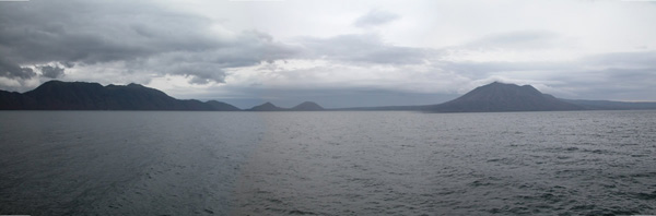
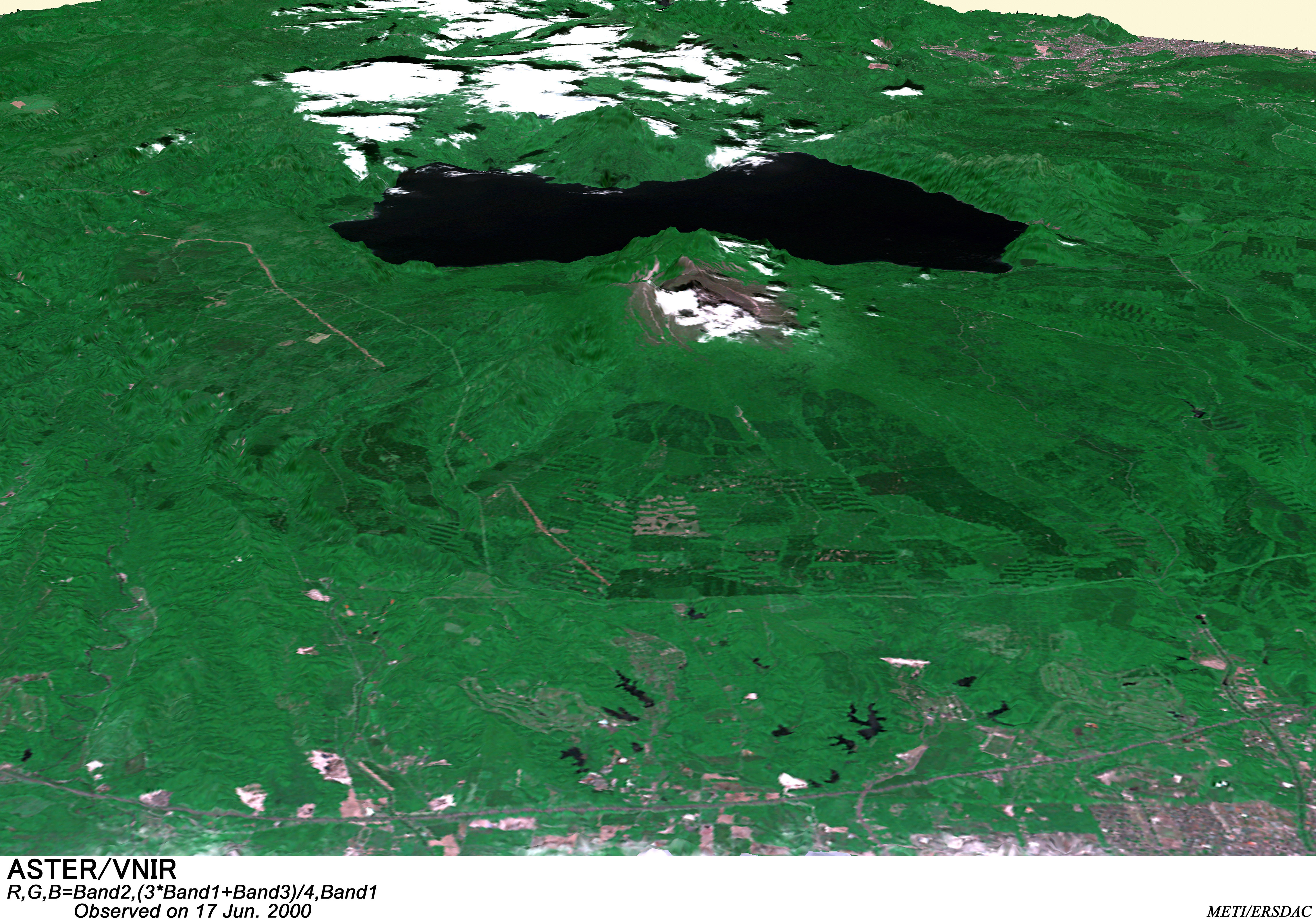
Picture - 1 Panoramic view of Shikotsu Lake This panorama picture of Shikotsu Lake is a composite of three pictures taken from Poropinai of Chitose city, at the northern side of the lake. The caldera lake was formed by a huge scaled eruption occurred about 40,000 years ago. Outer rim of a crater surrounds the lake as if it forms the wall of the caldera. Height of the outer rim of a crater is over 1,000m. After the caldera formation, Fuppushidake and Eniwadake became active in that order and now Tarumae Mountain (behind the mountain on the right side) on the southern side is active.
|
|
 |
 |
|
|
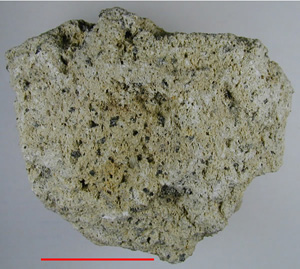 |
Picture - 4 A pumice stone in Tarumae Mountain The pumice stone was made in times of eruption in 1739. A pumice stone is formed by the sudden solidification of magma, which leads to rapid drainage of gas. Due to the porosity, some stones are light enough to float in water. Pumice stones in Tarumae Mountain are composed of andesite. Since the eruption in 1739, the mountain repeated small-scaled volcanic activities. In 1909, lava dome was formed at the mountaintop. Mountaineers are called to heed the danger of the exhalation activities. Red line in the picture indicates 5cm long. |
Copyright of Image - 1 and 2 belongs to JSS and that of text and Picture - 1 through 4 belongs to Prof. Yoshiyuki Koide of Sapporo Gakuin University. Permission of JSS is required of their use for other purposes.
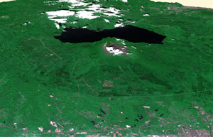
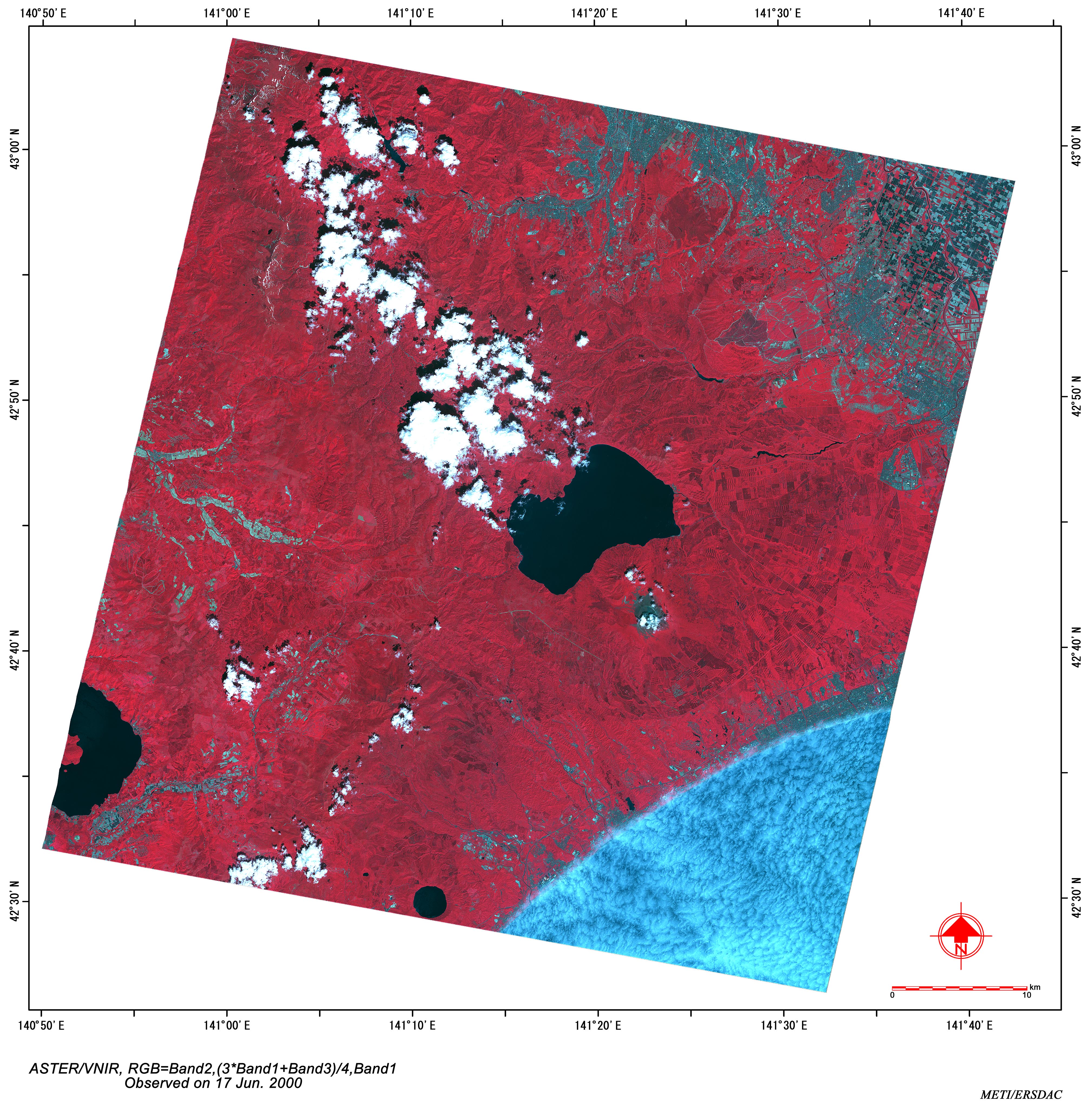
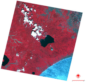 Image - 2 Satellite
image of Shikotsu Lake
Image - 2 Satellite
image of Shikotsu Lake