
A river is formed in the cycle of water: sea water evaporates in air and forms clouds, falls on ground surface as rain and runs into a river. In most cases, Japanese rivers originate in mountainous areas. Flows of rivers engrave various patterns on the ground. Water and earth are key components to form geographical features. What kind of terrain would it be when a river flows on a flat land surface? The answer can be found in a large continent.
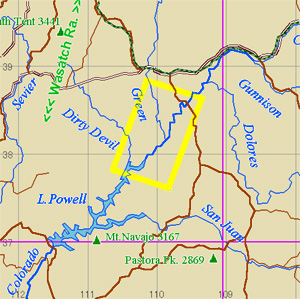
| Colorado Plateau,
located at the upper stream of Colorado River is from 2,000 to 3,000m
above sea level and stretches as long as 500km across. The world famous
scenic spot, Grand Canyon exists in the plateau. Another scenic spot,
Canyonlands National Park is located at a higher place, where you can
find out how continental river originates.
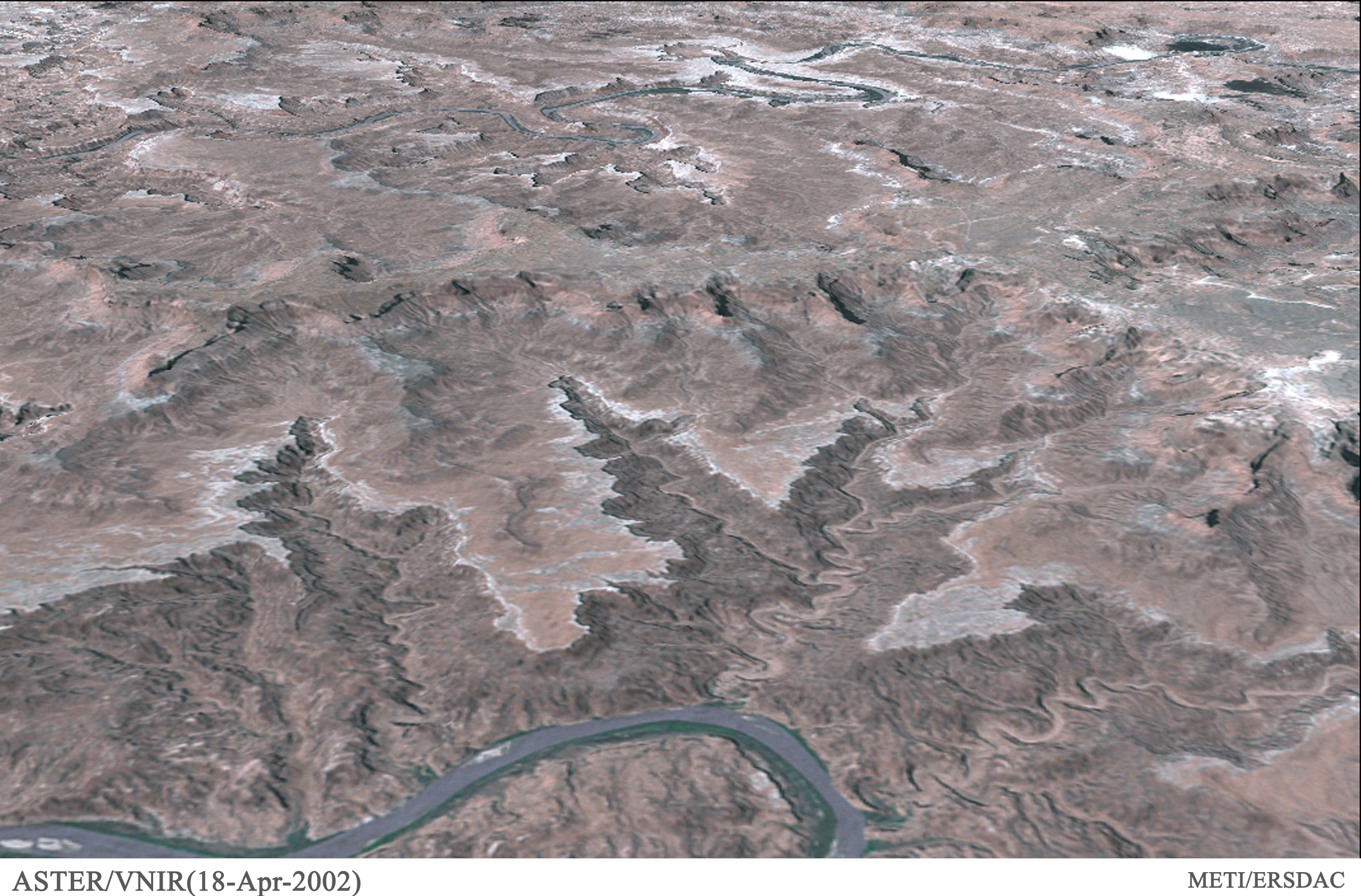
From the origin to the mouth into Gulf of California, Colorado River runs across multiple states: rocky mountain in Colorado, Utah, Arizona, borders between Nevada and Arizona and between California and Arizona and finally, United Mexican States. It is the sixth longest river, which has the sixth largest catchment area in the U.S. Grand Canyon National Park is located in the Colorado River basin in Arizona, while Canyonlands National Park in the southeast of Utah, a state facing Arizona to the south. At Grand Canyon, you can enjoy a dynamic landscape of deep valleys formed by the erosion of the river. What kind of a pattern will a river draw at the beginning of erosion? It must be thin and shallow. Then, what will happen when flow of the river keeps eroding the place over time? In case of rivers in Japan, the flow becomes thinner as coming near to the origin until the stream finally disappears at a ridge or a mountainside. In other words, start of a river is quiet and unnoticeable. This is the common recognition among Japanese of how a river originates. However, it is not the case with a river on a continent. Mysterious figure of the river origin is unimaginable to the people living on an island. The Colorado River starts all of a sudden. The point of origin looks as if water flows out of a hollow dug with a mammoth rake, and at another point from a hollow, which looks like a big coniferous tree. If you visit the place, you will forget that you are standing on earth. You will feel as if you are up in the air. At the same time, the terrain, which extends to hundreds of meters, seems like within the reach of your hand. The spectacular view just deserves to be called "Island in the Sky". The river origin that looks like the nails of dinosaur at one point, turn into small branches of a tree, where the river forms a much wider stream due to progressed erosion. The river start was so abrupt and unintentional just like a footprint of a capricious dinosaur. Although the start of the river is so sudden, small streams flow into the river if you look at it closely. But the small streams cannot be called part of the river because the place where they run is almost flat without erosion. The river origin starts quite abruptly. In a way of reversing common sense. But this is another figure of the river origin. Possibly, it is exceptional. The terrain, which extends to hundreds of meters still exists. The question "how had the mysterious terrain been formed?" occurs to us naturally. Science has an answer to that question too as well as any other questions related to natural phenomena. Such terrain generates over time on a flat layer of semi-arid climate or where arid and wet seasons repeat, such as in savanna or grasslands at the inner part of a continent. Under such conditions, river erosion occurs on a large ground surface area rather than along a line. Horizontal layer of a continent is consisted of several different types of rocks with different strengths. Hard rocks form a layer resistant to erosion, and form the base of a flat plain. A vast plain like "island in the sky" is geologically called a structural plain. Deccan Plateau in India and Lesotho Highlands in Africa are also called structural plains. When such flat areas are elevated by tectonic movements, a river does not divert its flow but works to keep the ground level before the elevation. Terrains called mesa and butte are formed as erosion progresses after elevation. If erosion further progresses and the next hard layer appears on the ground surface, a new structural plain will be formed. An old continent has gone through multiple of such cycles. Even though the logic of the mysterious terrain became clear, we do not seem to be able to completely wipe out the sense of wonder or impression. It is as if the great nature is making fun of the frivolous attempts of human beings to conclude the mystery. This is the origin of a river I found in "Island in the Sky". 2003. Aug. 1st
|
|
|
|
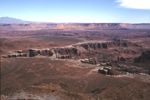
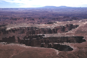
Picture - 1 Island in the Sky This is the origin of Colorado River located in "Island in the Sky". The huge and deep river origin is divided in three ends, which looks as if a giant dug the ground for fun. The mysterious figured river origin stretches hundreds of meters. |
 |
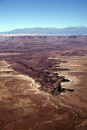
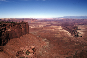
Picture - 2 Canyonlands National Park in Utah State The picture shows a huge hollow made by erosion. Not just the work of a river but factors such as geological feature, climate and time are prerequisite to form such extensive erosion. Once the ground is elevated, a river works to maintain the ground level before the elevation, which causes to enlarge a gap between the ground and the riverbed. Elevation of land is the answer to the mysterious figure of the river origin. |
 |
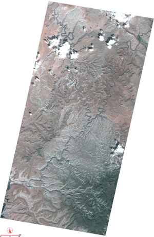
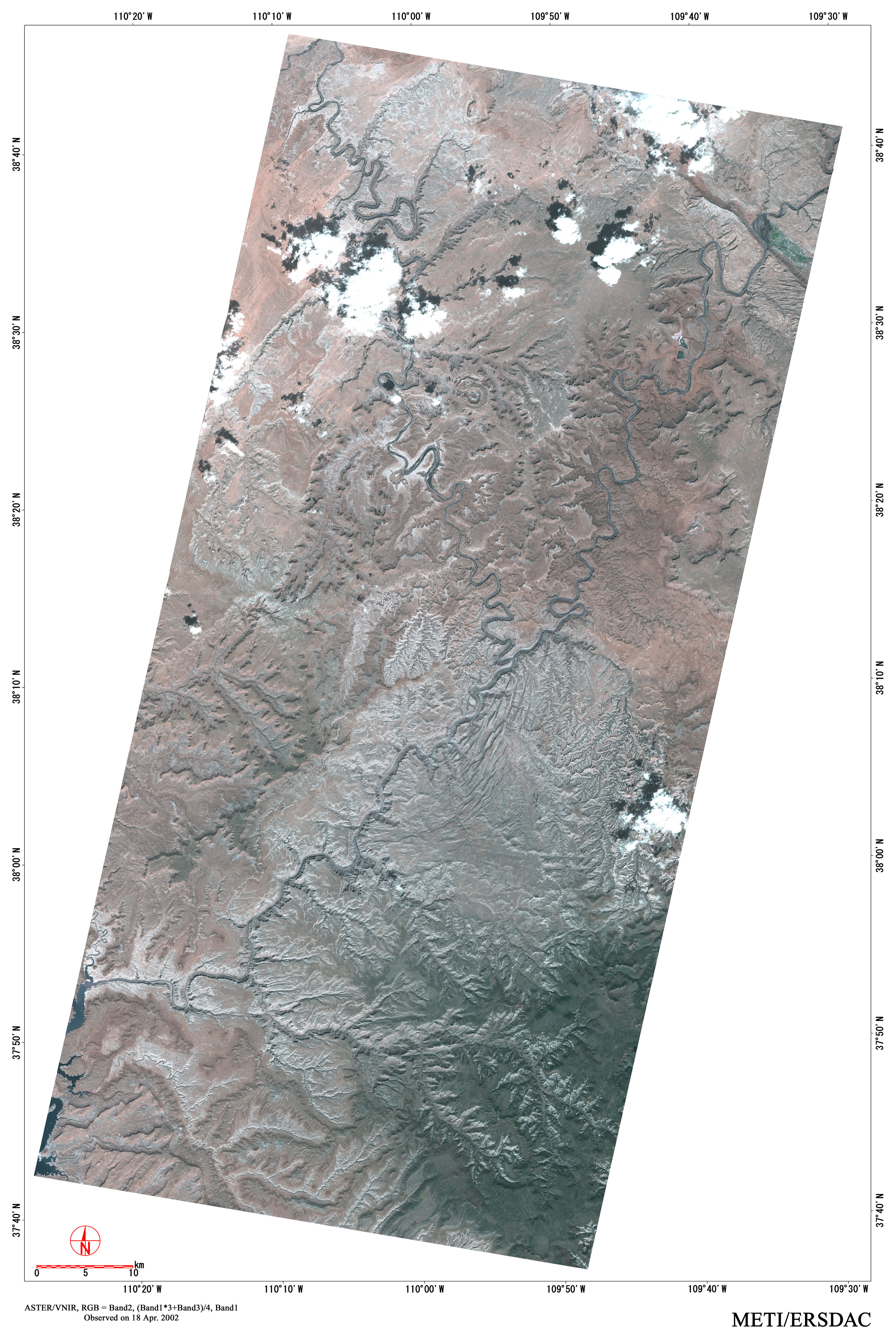
Picture - 3 Structural Plain This is another point of origin. Variation in the figure is another mystery. As erosion progresses, a deep vast valley like Grand Canyon will be formed. A hard layer at around the former ground level before the elevation will someday form a structural plain. In the process, terrain called mesa or butte will be formed. |
|
|
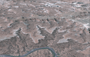
Picture - 4 Repeated effects This picture is a distant view of the same place as picture - 3. On the left side of the picture, surface of another structural plain can be seen. Structure plain is formed over time after land elevation. If another land elevation occurs to the structural plain, deep erosion will be formed. |
Copyright of Image - 1 and 2 belongs to JSS and that of text and Picture - 1 through 4 belongs to Prof. Yoshiyuki Koide of Sapporo Gakuin University. Permission of JSS is required to their use for other purposes.